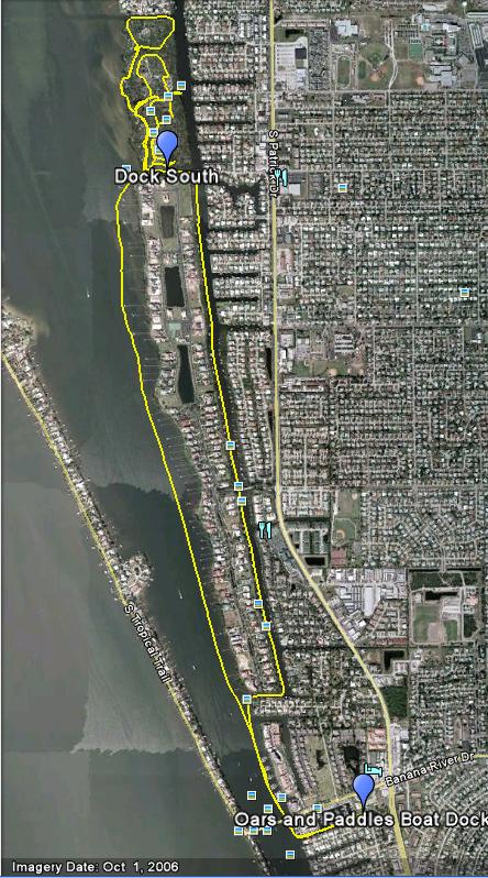
According to KayakGuide.com, you can put in at the Satellite Beach Fire Station and kayak a short distance to the island. However, upon arrival we found out that the ramp was closed for liability reasons. There was an information sheet box at the previous ramp site with some other ramp suggestions. We decided to go further south to Oars and Paddles park. Turns out this ramp is about a 2.5 mile paddle to the island. That is a pretty far distance going against the wind. We took the Banana River side up the island and the Grand Canal side back. The wind was crazy on the river. Once we got to the Island and paddled into the inner canals it was significantly easier to paddle.
 |
| Paddle Track |
 |
| Great Horned Owl |
 |
| Samsons Island |
This was my first paddle with my GPS and I really appreciated having it. My sense of direction is terrible and it helped me figure out where I was going on the island. I put the GPS in a small insert in my kayak seat while I was paddling. However, I forgot that it was there when we arrived back at the dock. As a result, my GPS took a ride on the top of my car in the kayak. I don't understand how it didn't fall out when I was pouring the water out of the kayak, but I was just grateful it was still there when I got home. I'll have to be more careful next time.
This is a great paddle. I'd like to do it again when it's cooler and maybe combine it with a camping/geocaching trip.
